
Free
Try Panomode on a real job.
$0 No card needed
Start free- 3 tours
- 1 GB storage
- 1 seat
- Public links, embeds and ZIP export
- A “Made with Panomode” badge on tours
Drag in panoramas from a 360° camera or a DJI drone. Panomode reads where each one was taken, puts the scenes on a map, links them, and shares the tour under your brand.
Free for 3 tours. Every new account gets a 14-day Pro trial, no card required.
Everything happens in the browser, so there is nothing to install.
Drop in equirectangular (2:1) panoramas from any 360° camera, DJI sphere panoramas or your stitching software. Your browser makes web-sized copies on your own computer, so the large originals never upload and uploads stay fast.
Panomode reads the GPS position and heading in each photo (DJI XMP or EXIF), puts each scene on the map and sets north for you. Auto-link then joins every scene to its nearest neighbours by compass bearing. Add info points wherever you need them.
Keep the tour as a draft, open it to a client’s portal or publish a public link. Embed it on any website with an iframe, or export a static ZIP that runs on any web host.
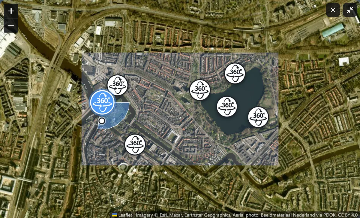
Panomode is built around the map, because that is how site work is shot and how clients find their way around it.
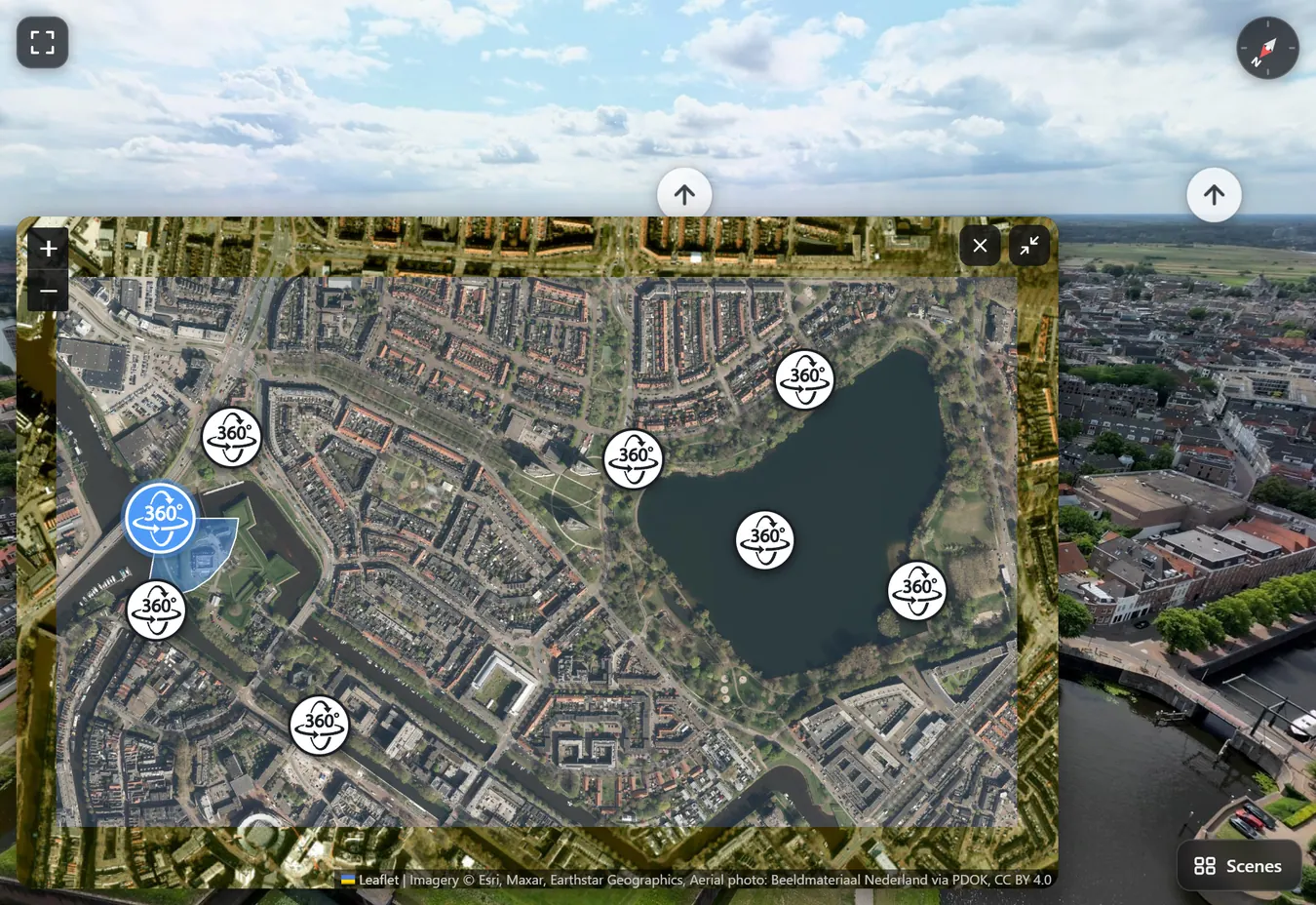
Import a GeoTIFF from your photogrammetry software and Panomode lays it over the map, under the scene markers. Your browser reprojects it from its coordinate system (UTM, national grids, any EPSG code) and shrinks it on your computer, so multi-gigabyte orthomosaics work.
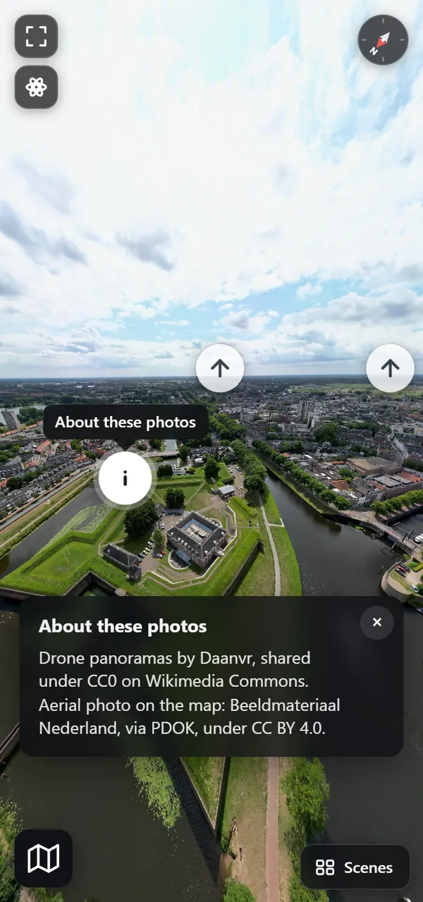
Clients open a link and look around, with nothing to install. On a phone they can simply turn to look.
Every tour has one of three visibilities. Change it whenever the job moves on.
Only your team sees it while you work on it.
The client’s people see it in their portal, next to their other tours.
Anyone with the link can open it, and it still shows in the client’s portal.
Prices in US dollars, excluding VAT and sales tax. Every new account starts with a 14-day Pro trial, no card required. When it ends you move to Free unless you choose a plan, and nothing is deleted.
Showing monthly prices. Yearly plans are billed once a year, with two months free.
Try Panomode on a real job.
$0 No card needed
Start freeFor a photographer or drone pilot delivering tours to clients.
$19 per month Billed monthly.
$190 per year Billed once a year. Two months free.
Start 14-day trial Start 14-day trialFor studios and survey teams with automations.
$49 per month Billed monthly.
$490 per year Billed once a year. Two months free.
Start 14-day trial Start 14-day trialThe trial is Pro. Choose Team in the app whenever you need the API or more seats.
| Feature | Free | Pro | Team |
|---|---|---|---|
| Limits | |||
| Tours | 3 | Unlimited | Unlimited |
| Storage | 1 GB | 25 GB | 100 GB |
| Seats | 1 | 3 | 10 |
| Sharing and branding | |||
| Public links, embeds and ZIP export | Included | Included | Included |
| Client portals | Not included | Included | Included |
| Your logo and your clients’ logos on tours | Not included | Included | Included |
| “Made with Panomode” badge | Shown | None | None |
| Automation and support | |||
| REST API and API keys | Not included | Not included | Included |
| Priority email support | Not included | Not included | Included |
Something missing? Email us at info@panomode.com.
Equirectangular panoramas with a 2:1 aspect ratio: from any 360° camera, DJI drone sphere panoramas, or stitching software.
No. Your browser makes web-sized copies of each photo on your own computer and uploads those, which keeps uploads fast. The originals stay with you. The one exception is a file your browser cannot process: Panomode uploads that file and makes the copies on the server instead.
Place each scene on the map by hand, then set north by picking a landmark you can see on the map.
GeoTIFFs from photogrammetry software such as DJI Terra, Pix4D, Metashape, WebODM and iTwin, in UTM, a national grid or any other EPSG coordinate system. Your browser reprojects and shrinks the file, so multi-gigabyte orthomosaics are fine.
Yes. Copy the iframe from the tour’s Share dialog. The embed address carries its own key, so it works whatever the tour’s visibility. You can also export a static ZIP and host it anywhere, with no server.
Two ways. A client’s portal link signs in whoever opens it, without a password. Or create personal accounts for the people at a client. Client portals are on the Pro and Team plans.
No. Every new account gets 14 days of Pro without a card.
You move to Free unless you have chosen a plan. Nothing is deleted: every tour, link and client portal keeps working. The Panomode badge comes back, your logos are hidden, and new tours, clients and team members are held to Free’s limits (3 tours, no clients, 1 seat). Choose a plan at any time to lift them.
You keep everything you already have. You cannot add tours, storage, seats or clients beyond the new plan’s limits, and features of the bigger plan (no badge, logos, the API) stop applying.
Yes, on the Team plan. The REST API and API keys let your own scripts create tours, upload scenes and link them.
No. There are no analytics and no tracking cookies on this site or in the app, only the session cookies that keep you signed in. When a tour has a map, the visitor’s browser loads map tiles from Esri or OpenStreetMap. The privacy policy has the details.
Every new account starts with 14 days of Pro, no card required.